
Iceland. The land of fire and ice. We’ve been here before. We’ve see the cliffs where land meets sea. We’ve seen glaciers and caverns. But it’s Iceland. So we’re back.

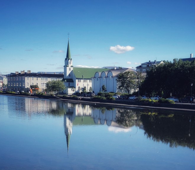
Outside of Hallgrimskirkja, Reykjavik, Iceland
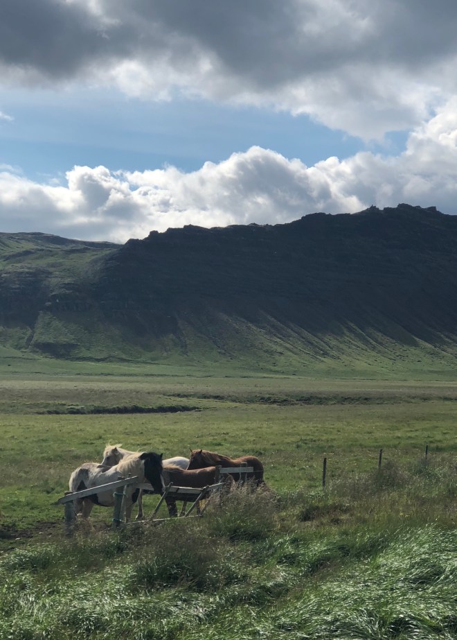
This time, we’ve traveled farther afield, driving Iceland’s route 1. The “Ring Road.” Two lanes wide in most places with single-lane bridges over rivers of glacial melt. Icelandic horses and free roaming sheep far outnumber the cars and campers.

At 1330km (830 miles), Iceland can be circumnavigated in about 16 hours non-stop. But this is unrealistic because the best parts of the Ring Road involve stops for photos and hikes to waterfalls. Most guidebooks and locals will say you need 10 days to give Iceland the time it needs. On a long weekend, it’s best to identify a couple of regions and focus attention on them. To help narrow it down, we highly recommend Lonely Planet’s “Iceland’s Ring Road”. If you go in summer, you’ll have at least 16+ hours of sunlight, which we found advantageous for seeing as much of the country as possible.
Friday – The Golden Circle
Just an hour outside of Reykjavik city center, a geysir, Iceland’s largest waterfall (Gulfoss), and the site where Iceland began. This is the heart and soul of Iceland.
The first site is Thingvellir, which is an iconic Icelandic site.

It was here that the Vikings established the world’s first democratic parliament in AD 930. The location of the actual meeting spot is merely a stone circle with a few stone steps in either cardinal direction. The structures standing now are the Prime Minister’s summer house from the early 20th century and a small church dating from 1859.


Two favorite sites dominate here – the rift in the tectonic plates dividing the continents of North America and Eurasia and Oxararfoss, a small but powerful waterfall that falls down the rift.


The hour and a half drive from Thingvellir to Geysir can be absolutely gorgeous with the foothills falling into Thingvalavatn lake. Geysir is covered with tourist and tour busses, but it’s worthwhile to get out of the car for a few minutes to see Geysir’s little cousin Strokkur gush (which it does every ten minutes or so 15-30m high). It’s a weird, post apocalyptic feeling when walking along land next to pools of bubbling, boiling water coming up from the center of the Earth. The hiking is nice here with a gradual up-hill jaunt that gives a great view of the explosion of water below.

The best part of the Golden Circle comes next at Gulfoss. Just a short 15 minute drive along the hidden canyon. Gulfoss is a double cascade of the Hvita river, with the steepest part falling into a deep canyon. The power of the thunderous water is palpable as soon as you start down the walkway with the mist traveling almost a football field from where the fall happens. In summer’s 50 degrees, its refreshing. In winter, it’s a scene from Disney’s Frozen. Pretty wild.


We decided to make our home base at Icelandair Hotels Fludir, which is set in a small agricultural town surrounded by geothermal activity. The hotel is set up like little cabanas on two wings that surround a central courtyard with two geothermal pools.
A short drive from Fludir is the cater Kerid. It was formed 6,500 years ago and a perfect circle 270m in diameter, 170m in radius, and 55m deep. It was formed through volcanic eruption that displaced magma underneath the site of the crater allowing the Earth’s surface to collapse inward.


One of the best restaurants outside of the city is located in the small town of Stokkseyri and it is a secret that Icelanders hold dear: Fjorubordid Restaurant. They specialize in one thing and one thing only – the gorgeous, silky smooth, juicy, langoustine.


Saturday – South Shore
While the Golden Circle tour afforded a lot of sights in a short drive (duration and mileage), our south shore tour de force is just that: 8 hours driving, 676km out and back. This segment of the Ring Road features waterfalls, black sand basalt beaches, glacial lagoons, cliffs, and vast stretches of emptiness. We made strategic stops to grab some beer and ice, snacks, and petrol considering the opportunities are few and far between along the road.
Seljalandsfoss is a unique stop along the Ring Road. While it can be chock-full of tourists, it is a unique spot insofar as you can walk behind the waterfall. Although steep, slippery, and cold, there is nothing quite like it.


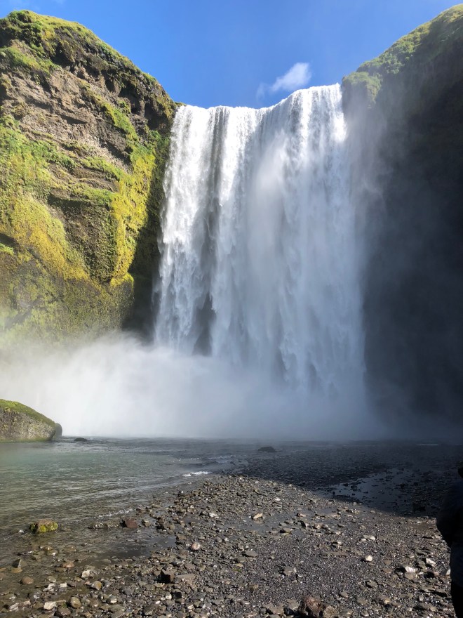
Skogafoss is a 62m high powerful waterfall with a steep staircase up the side to give views of the waterfall and valley beneath. The hiking here is great, with a nice walkway along the river.


Just before the town of Vik is Reynisfjara, which gives access to the beautiful black sand beaches and an incredible mountain side of basalt columns that are reminiscent of those in the Giant’s Causeway (Northern Ireland).

A stones-throw offshore are two sea stacks, which Icelandic tradition claims are masts of ships that trolls were stealing when they got caught by the sunlight. The Northern Atlantic here is cold and fierce, with signs warning of rogue waves all over the beach. Further offshore is a large plateau-like stone with an arch where puffins are often seen frolicking.


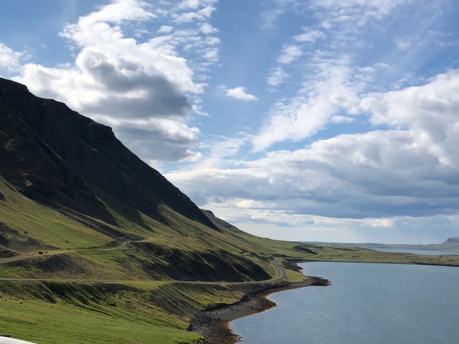
The stretch of the Ring Road east of Vik is a combination of striking cliff faces falling down into the plains along the coast. Views of the huge glacier Vatnajokull grow plentiful the further east you drive.

There are plenty of places to stop along the way to catch some unique sights like the old turf-roofed farm at Nupsstadur.


The goal of today’s drive is to get to the glacial lagoons of Fjallsarlon and Jökulsárlón, which takes you across the unreal Skeidararsandur. The sandar is a region characterized as vast stretches of emptiness, repeated powerful rivers cutting under the Ring Road, and views of the glacier in the distance. The sandar has been created by powerful glacial runoff, which carries silt, sand, and gravel down from the mountains. It was hard to capture the feeling of driving across this space in the middle of summer when the rivers – albeit moving very quickly – were not as large as they appear to be during the spring.

Skaftafell is our next stop, just after the sandar. It is Iceland’s most popular national park and is a great campsite for an overnight stay. We stop by for the 45 minute up-hill hike to Svartifoss. Svartifoss is stunning; water falling down black geometric basalt columns, that, depending on the sun, attain a mosaic like coloring.


Fjallsarlon and Jökulsárlón are separate by 10km on the South Shore. Both are easily accessed by parking lots just off the road and a short trail to the shore of the lagoons. Fjallsarlon is smaller and less crowded and allows for easy access to parts of glaciers floating up to the shore.


Jökulsárlón is iconic with crystal blue water and ton-sized chunks of bobbing white glaciers. Both offer the perfect opportunity to share a beer and talk about all of the sights from the day’s trip.


The return drive to Vik for dinner at Berg, featuring local lamb and perfectly cooked seafood, is stunning as the sun shifts slightly in the summer sky casting lovely shadows on the side of the cliffs.

Sunday – Northwest of Reykjavik
The drive from Fludir to Borgarnes is long, not by distance but by time. Back-tracking to Thingvellir, the drive takes you up route 550, which in the first bit criss-crosses the tectonic plates as it climbs to a lake in the middle of the mountains. Here, you can be all alone except for the sheep scaling the mountain cliff.

Route 550 turns to gravel as you meet up with Route 52. This stretch of motorway, unpaved in many places gives you a picture perfect view of Iceland’s lush interior.
The greenest green grass waves in the wind as you drive past farm after farm, eventually pouring out onto a fjord before entering the town of Borgarbyggd, where we ate at a cute little barn called Englendingvik.


The drive from here south toward Reykjavik invites a scenic detour around the Hvalfjordur fjord, which can normally be by-passed by those in a hurry through the tunnel under the fjord. The road around the fjord can be harrowing yet fun along the steep cliff side.
The reason for the detour is the hike to Glymur. Glymur is the second-highest waterfall in Iceland, with a cascade of 198m. The hike there is an afternoon-long affair, with trails that are combinations rocky, steep, and require climbing across a log bridge in the summer. While doable, it requires a time commitment to fully take in the glory of Glymur.


The evening is spent in Reykjavik, having a delicious meal at KOL and soaking up the late night sunset.


Monday – Reykjavik Center
It’s the day of departure from Iceland so we head to the public pool at Laugardalslaug. The pool is huge with multiple lanes for swimming, 5 different pods to soak of geothermal heat, and a sea salt bath. Towel rentals are easy and the admission is a quarter of the price at the Blue Lagoon. This is where Icelanders come to play.
Just before getting on the road to the airport, we have our last hot dog and beer down the street from the pool at the Reykjavik Sausage Company.


* * * *
Iceland’s Ring Road is perfect for a week away, but it also presents the peacefulness and tranquility that we need on a weekend away. Restored by nature, presented with geological wonders, and soothed by water heated by the Earth’s core… Iceland, the land of fire and ice, is perfect for mind, body, spirit.
